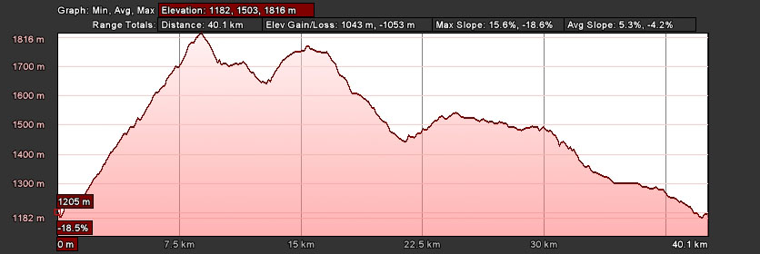
This route is the shortest ride we list in the Cortina d'Ampezzo area, but doesn't lack for beautiful scenery, or for the effort needed on the initial climb out of Cortina.
We'll climb out of Cortina (1258m) to Passo Tre Croci (1805m) on the "Strada delle Dolomiti" gaining a respectable 547m (1800'), including a couple of steep sections!
The "Road of the Dolomites," a tourist road envisioned in the late 19th century and completed in 1909, connects Austria with Trento, Italy, passing through the heart of the Dolomites. Many of our Cortina area rides include sections of this famous and beautiful road (its official designation is "Strada Statale" SS 48).
After descending from Passo Tre Croci we'll take a left at the junction (1644m) of the roads to Misurina (SS 48 bis) and Auronzo di Cadore (SS 48), climbing slightly to reach Lago di Misurina (1750).
We'll face two small passes and enjoy two fast descents on our return to Cortina. First, Col Saint Angelo (1756m)—yes, it's a 6 meter climb from Lake Misurina, but it's followed by a nice descent to the junction with SS 51 (1453m). Second is Passo Cimabanche (1529m), which follows a gradual (~2%) climb of only 66 meters, before our nice, fast descent into Cortina.
Those seeking a few extra kilometers can add and out-and-back to Dobbiaco by turning north at Carbonin (1451m), which provides a fast 13.5 Km descent to Dobbiaco (1205m). Of course, you would have to climb back to Carbonin, but the 246m (733') difference isn't too difficult at an average grade of 1.8%!
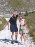
North of Lake Misurina is Monte Piana, site of some significant World War I battles, and the open air museum is worth the hike. (
More about Monte Piana)
Note: Route information comes from a variety of sources, including commercial products, personal experience, and from the public domain, and is always subject to errors, whether at the source, during computation, or at transcription, and is provided "as is"—to be used "at your own risk."

 Cortina d'Ampezzo, long famous for its hiking and climbing, became world famous by hosting the 1956 Winter Olympics.Today, wonderful road cycling and mountain biking make Cortina a "must go" destination for active sports enthusiasts.Picture yourself riding, hiking, and mountain biking among the Dolomites' shear rock faces!
 The Mortirolo, Gavia, & Stelvio–These famous Giro passes challenge you with their long climbs and fast descents!Bormio's picturesque alpine setting is perfect for tackling these passes, and its quiet old town center provides a true "Italian" experience!Less famous, Bormio's hiking and MTB are equally world class!
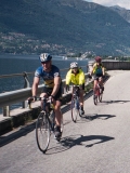 There's nothing like the water, sky, and mountains of Lago di Como!Popular with Italians for their summer vacations, countless boats of all varieties dot the deep blue water.After cycling and hiking among the lakeside villas and gardens, we "get out on the water," with a ferry ride back to our hotel!
 Wonderful biking and hiking around the Apli Apuane marble quarries of Michelangelo fame!Appearing snow-capped in summer, due to the bright-white marble, we hike and bike trails and roads built over 2000 years!With a scant 5 Km between alpi and mare–and the beach–our apres sport is a nap in the sun, and a dip in the Mediterranean!